Ifc Georeference
Georeference the Ifc Context.
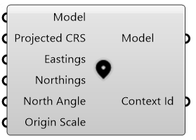
Input
-
Model*: the IfcOpenShell model.
-
Projected CRS: the EPSG code for the projection (default is 4326; i.e. WGS84).
-
Eastings: the longitude of the project (default is 0.0).
-
Northings: the latitude of the project origin (default is 0.0).
-
North Angle: the angle between the project and world north, counterclockwise is positive (default is 0.0).
-
Origin Scale: the scale at the origin (dafault is 1.0).
* Required
Output
-
Model: the IfcOpenShell model.
-
Context Id: the context id.